Plate 1 figs. a–h · 8 separate observations


Every figure is a research-grade observation under CC0, CC BY or CC BY-SA, rehosted with the photographer’s name, the licence and the observation it came from. Photographs under a NonCommercial licence are excluded from this site and are never stored, which costs us a great many pictures and is not negotiable.
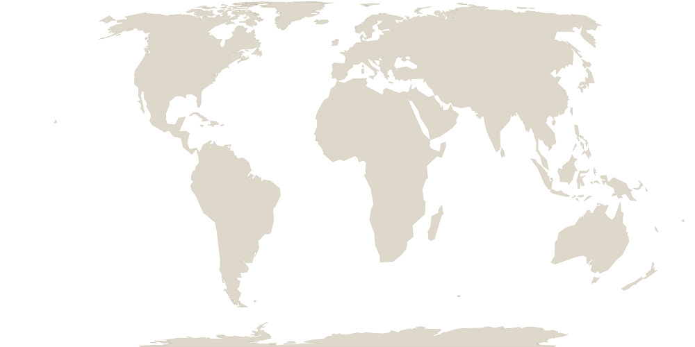
Native range 61 botanical countries
| Region | TDWG code | Continent |
|---|---|---|
| Alabama | ALA | NORTHERN AMERICA |
| Alberta | ABT | |
| Arizona | ARI | |
| Arkansas | ARK | |
| British Columbia | BRC | |
| California | CAL | |
| Colorado | COL | |
| Connecticut | CNT | |
| District of Columbia | WDC | |
| Florida | FLA | |
| Georgia | GEO | |
| Idaho | IDA | |
| Illinois | ILL | |
| Indiana | INI | |
| Iowa | IOW | |
| Kansas | KAN | |
| Kentucky | KTY | |
| Louisiana | LOU | |
| Maine | MAI | |
| Manitoba | MAN | |
| Maryland | MRY | |
| Massachusetts | MAS | |
| Mexico Northeast | MXE | |
| Mexico Northwest | MXN | |
| Michigan | MIC | |
| Minnesota | MIN | |
| Mississippi | MSI | |
| Missouri | MSO | |
| Montana | MNT | |
| Nebraska | NEB | |
| Nevada | NEV | |
| New Brunswick | NBR | |
| New Hampshire | NWH | |
| New Jersey | NWJ | |
| New Mexico | NWM | |
| New York | NWY | |
| Newfoundland | NFL | |
| North Carolina | NCA | |
| North Dakota | NDA | |
| Northwest Territories | NWT | |
| Nova Scotia | NSC | |
| Ohio | OHI | |
| Oklahoma | OKL | |
| Ontario | ONT | |
| Oregon | ORE | |
| Pennsylvania | PEN | |
| Prince Edward I. | PEI | |
| Québec | QUE | |
| Rhode I. | RHO | |
| Saskatchewan | SAS | |
| South Carolina | SCA | |
| South Dakota | SDA | |
| Tennessee | TEN | |
| Texas | TEX | |
| Utah | UTA | |
| Vermont | VER | |
| Virginia | VRG | |
| Washington | WAS | |
| West Virginia | WVA | |
| Wisconsin | WIS | |
| Wyoming | WYO |
Region boundaries approximated from Natural Earth (public domain) and mapped to TDWG World Geographical Scheme for Recording Plant Distributions (WGSRPD) level-3 botanical countries (Brummitt 2001). Indicative, not the official WGSRPD geometry.
Flowering 1,334 in flower of 1,374 examined
Peak flowering in Sep. Each bar is the share of Symphyotrichum lanceolatum observations in which someone actually recorded the reproductive state and found the plant in flower, not the raw number of flowering records. That distinction matters: people observe plants far more in spring than in winter, so a bare count of flowering records partly measures when people go outside. Dividing by the number examined removes that. 1,334 of 1,374 examined observations were in flower, every one of them research grade. The whisker on each bar is a 95% Wilson interval. 6 months have fewer than 5 examined observations, so no proportion is drawn for them. This is still a global aggregate and not a forecast for your garden: the same species flowers on different dates in different hemispheres. Where a species has fewer than 30 flowering records we do not draw this chart at all. Computed from 10.15468/dl.cgje2x.
Where it actually grows measured, from 2,030 observations
| Condition | 5th percentile | Median | 95th percentile |
|---|---|---|---|
| Coldest month, mean daily low | -17.8 °C | -9.4 °C | -0.5 °C |
| Warmest month, mean daily high | 22.5 °C | 25.8 °C | 31.2 °C |
| Annual rainfall | 467 mm | 970 mm | 1,347 mm |
| Rainfall in the driest quarter | 49 mm | 191 mm | 283 mm |
It is found where winters are severely cold. This is not care advice and it is not a forecast. It is a measurement: we sampled the climate at every one of the 2,030 research-grade observations of Symphyotrichum lanceolatum that carry a coordinate, and this is the range those places actually span. The 5th and 95th percentiles are used rather than the minimum and maximum, because a single cultivated specimen in a heated conservatory should not widen a tropical plant's range to the Arctic.
This is not a hardiness zone. A USDA zone is the average annual extreme minimum temperature. The figure above is the mean daily minimum of the coldest month, which is a different quantity and is typically far warmer. Reading one as the other would place a plant several zones too warm, so we do not publish a hardiness zone, because we do not have one. Climate from CHELSA V2.1 (Karger et al. 2017); occurrences from 10.15468/dl.cgje2x.
Also published as 60 synonyms
A synonym is not an error. It is a record of botanists disagreeing, in print, about where this plant belongs. Each of these was somebody’s considered answer.
- Aster abbreviatus Nees
- Aster angustus Nees
- Aster bellidiflorus Willd.
- Aster bellidiflorus var. angustus (Nees) DC.
- Aster bellidiflorus var. bellidiflorus
- Aster bellidiflorus var. rigidulus (Nees) DC.
- Aster bellidiflorus var. rubricaulis DC.
- Aster carneus Baker
- Aster coerulescens var. laetevirens (Greene) Cronquist
- Aster coerulescens var. wootonii Wiegand
- Aster cornuti Wendl. ex Nees
- Aster dracunculoides Willd.
- Aster durus Lunell
- Aster fluvialis Osterh.
- Aster foliaceus var. hesperius (A.Gray) Jeps.
- Aster hesperius A.Gray
- Aster hesperius f. hesperius
- Aster hesperius var. hesperius
- Aster hesperius var. laetevirens (Greene) Cronquist
- Aster hesperius var. wootonii Greene
- Aster interior Wiegand
- Aster laetevirens Greene
- Aster lamarckianus Nees
- Aster lamarckianus var. lamarckianus
and 36 more.
Sourcesevery claim on this page
- World Flora Online Plant List. accepted name, authority, classification. CC0. Retrieved 2026-07-12.
- iNaturalist. photographs and flowering annotations, CC0 / CC BY / CC BY-SA only. per photograph. Retrieved 2026-06-27.
- Wikidata. common name (P1843), joined on the World Flora Online identifier (P7715). CC0. Retrieved 2026-07-13.
- Kew, World Checklist of Vascular Plants (WCVP v16). native distribution by TDWG level-3 botanical country, and life form. CC BY 3.0. Retrieved 2026-06-04.
We publish what we can source and we say so when we cannot. This page has no care advice and no toxicity claim, because we do not yet have those from a source we can cite.